Well, that was exciting…It is not often that this remote and dusty corner of England shows up on the national news, but the earthquake of last night was certainly an interesting seismological experience.
Lincolnshire is not exactly an active seismic area, as the BGS press release shows

The last event of any note was in 1703 in the Humber Estuary, so it is the first time my house has had a good shake since it was built.
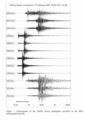
Having been briefly shaken out of bed last night, I have spent the morning working playing with Google Earth to plot the epicentre of the earthquake and see how close it really was. Just 3-4 miles, in fact, although the location moved from east to north of Market Rasen as the BGS updated its reported data in the morning.
Of course, Google Earth is like a chinese meal, you want another hit shortly after, so I also had to look up the official Dullest Place in Britain (Grid square SN8323) as determined by BBC Home Truths listeners who must have quite a bit of time on their hands to have scanned through the full set of OS Landranger maps to find the emptiest square.
This notable location is not so very far away in North Lincolnshire. I should however say that Lincolnshire Wolds are much more interesting than that, we do at least have contour lines, and we now also have our very own seismographs…
The interesting technological feature of the night was that almost as fast as thought itself, my daughter received many texts from friends from the local area, reporting example, that their parents were running around panicking, but that they were chilled (of course).
In the end, my wife summed it up stoically to my daughter:
“It’s just an earthquake, dear, go back to bed”


